

Tribal voices power public art project on the Mississippi River
A cartographer is leading a basin-wide project that aims to put Indigenous knowledge of the Mississippi River on the map.
A cartographer is leading a basin-wide project that aims to put Indigenous knowledge of the Mississippi River on the map.

A unique human-mollusk partnership at the Minneapolis Public Works water treatment plant provides early alerts on pollution.

Two artists have built over 400 temporary glass sculptures in the basin, highlighting hidden connections between its rivers and streams.

A cartographer is leading a basin-wide project that aims to put Indigenous knowledge of the Mississippi River on the map.

GALENA, Ill. — Standing on a bluff above the Mississippi River, cartographer Margaret Pearce read aloud the names that different tribal nations have for the water that flowed below them.
Nįįxete. Nyidąna. Nyitanga. Ḣaḣa Wakpa. Medisibowi.
Her audience — some who had never said the words before, others who knew them well — repeated them back. They’d gathered here in northwest Illinois to view Pearce’s new public art project.
The people who used those names lived with and alongside the upper Mississippi River for thousands of years. Pearce, a Citizen Potawatomi Nation member, contends their knowledge and understanding of the river have been washed over as the U.S. government tries to control and restrain it.
Her project, called Mississippi Dialogues, is meant to change that.
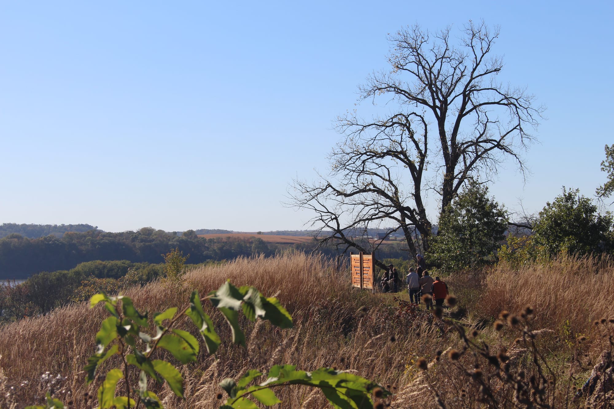
Through a 2025 MacArthur Fellowship "genius grant" and other funds, Pearce created two large-scale sets of maps of the river, one in Galena and one in Red Wing, Minnesota. The maps feature perspectives from interviews with dozens of tribal elders and knowledge holders, bridging old stories with new reflections and bringing together the voices of five tribal nations: Ho-Chunk, Ioway, Otoe-Missouria, Meskwaki and Dakota.
The Galena panels debuted Oct. 18 at Casper Bluff Nature Reserve, with artwork on the other side of the map by Ho-Chunk artist and Wisconsin resident Chloris Lowe III. The Red Wing panels, debuted Oct. 3 at the city's Colvill Park, feature art by Red Lake Nation member Ben Spears.
Pearce said she hopes to create 12 more panels for public viewing, tracing the river all the way to the Gulf.
"Maps can make Indigenous homelands ... and cultural knowledge visible to people who may not see that in the regular course of their lives," Pearce said. They "reveal those places that are all around them, and those people that are all around them."
Pearce was conceptualizing the project long before she received funding for it. At a 2019 map workshop at Northwestern University, she realized that the maps used in discussions of the upper Mississippi were maps of the river's lock and dam system. During the Great Depression, this system turned the free-flowing river into a series of pools to enable passage for shipping traffic.
"[They depict] an artificial river ... and it's all recent," she said. "I thought, 'Wow, it’s such an opportunity for cartography. What happens if we really listen to tribes whose knowledge and experience of that river goes back to time immemorial?'"
Pearce traveled the entire river twice, meeting with tribal historic preservation officers to explain what she wanted to pursue with the project. Then she and others conducted interviews, collecting stories, memories, worries and dreams for the Mississippi River.
On the resulting panels, excerpts from those interviews surround the river, the many voices coming together as if in conversation. Pearce based her map on a series of maps created during an 1890s-era survey by the Mississippi River Commission — before the locks and dams were created. In the series, the whole river is categorized by its different ecosystems, like floodplain forest, wet prairie, sandbars and open water, Pearce said.
"It's really great for creating an image for people about what an unpaved and unchannelized river looks like," she said.
Twenty-three tribal knowledge holders agreed to have their words appear on the map panels in Red Wing, and 22 on the panels in Galena. For the Ho-Chunk Nation and the Prairie Island Indian Community — Dakota people who live near what is now Red Wing — those interviews and more also now live in an archive for each community.
"It's hard to encapsulate everything through time of what the river means to us as a people," said Bill Quackenbush, a member of the Ho-Chunk Nation and its former tribal historic preservation officer. "That river is very important to us. ... That river is us."
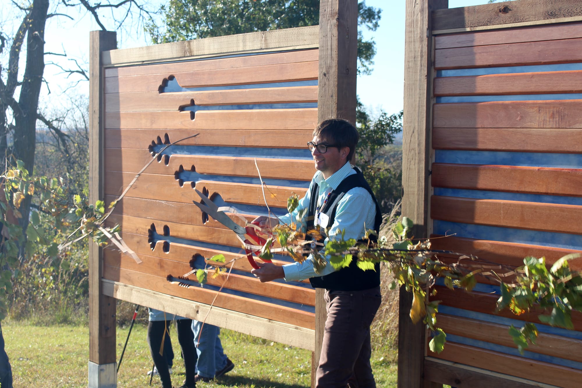
Chloris Lowe Jr., whose son provided art for the Galena panels, served two terms as president of the Ho-Chunk Nation. He told the group gathered in Galena that in 1874, his grandmother was forcefully relocated from the area by the U.S. government to Nebraska in a mass removal of Ho-Chunk Nation people. The following year, she and others returned via the Mississippi River to resettle where they once lived.
To see his son's artwork now overlooking the very bluffs and stretch of river that she traveled, Lowe Jr. said, feels "good in the heart."
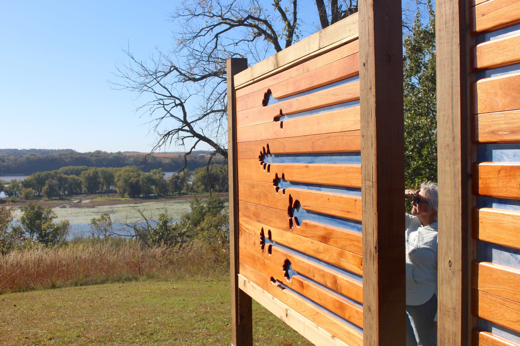
On top of Casper Bluff, the art installation is positioned perpendicular to the river below. It was intentional, Pearce said, not to block the expansive view.
In Lowe's piece, a sheet of aluminum painted blue stands out, cloud-like, against Spanish cedar. His carvings don't represent specific clans, he said, but general sky, land and water figures. Lowe said he initially had planned to take the piece in a different direction, but felt drawn to the excerpts on Pearce's side that evoked transition and movement between lifespans. The carvings seem to stretch from one panel to the next, each connected by a straight path that suggests a boundless presence.
"I have a hope that it just does the space justice," he said.
Spears, the arborist and wood artist behind the Red Wing installation, said he chose white oak because it grows on the hillsides around the river. His design depicts a rabbit, beaver and deer — all animals that live along the river — and the four seasons, all identified in the Dakota language.
Spears said the project tested the limits of what he could create with wood, a material that he described as "like fingerprints — you're never going to find the same grain."
"I feel we all have a connection with the river," he said. "Dakota, they're the tribe that's there [on Prairie Island], but it's for everyone to experience."
The Casper Bluff Nature Reserve is managed by the Jo Daviess Conservation Foundation, which has partnered with the Ho-Chunk Nation on projects to protect sacred land and traditions, including growing an Indigenous corn variety, gifted by Quackenbush.
Foundation CEO and president Nathan Aaberg said Pearce's project honors the people who always took care of the land and the river — and forges a path forward for Indigenous people and others to keep protecting it.
"We tend to accept that what we see today is the way things have always been," Aaberg said. "In [Pearce's] map we see the full power of the Mississippi, what its life was like. We need to remember that."
As much as the project is about remembering, it's about looking forward, too, to a future where Indigenous perspectives on the river are valued in concert with what has come more recently.
The Ho-Chunk Nation's Quackenbush said the ways the river has changed in the last several hundred years is concerning. Still, he said, it remains an important place of solace.
"I know, from this day to my dying day, the Mississippi's going to play a large influence in my life, and my community's lives," he said.


Two artists have built over 400 temporary glass sculptures in the basin, highlighting hidden connections between its rivers and streams.

In a tense meeting, SpaceX managers told locals the massive spaceport won’t affect them at all. Then locals pressed for specifics.


A support group and a lab in the St. Louis area provide resources for people with the allergy to mammal products — and evidence that its effects can be reversed.


The Mississippi Alluvial Valley was once the ‘breadbasket’ of black bears

Environment and agriculture news from across the Mississippi River Basin — delivered straight to your inbox.